How to Find a New Fishing Spot Using Wyoming Game and Fish Maps
It's a familiar feeling, isn't it? You've fished the same handful of spots for years, maybe even decades, and while they're reliable, that itch for something new—a fresh challenge, an untouched bend in the river, or a hidden high-alpine lake—just won't go away. The vastness of Wyoming's fishing opportunities can be intimidating, making it tough to figure out where to even begin looking for those next honey holes. But what if I told you that the best tool for uncovering new fishing spots is readily available, often overlooked, and incredibly detailed? We're talking about the Wyoming Game and Fish Department (WGFD) maps, and this guide will walk you through exactly how to harness their power to expand your angling horizons.
Understanding the Treasure Trove: What Wyoming Game and Fish Maps Offer
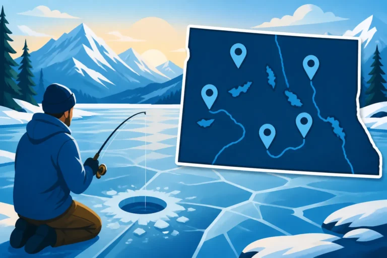
The Wyoming Game and Fish Department isn't just about regulations and licenses; they're also a goldmine of information when it comes to locating prime fishing real estate. Their mapping resources are extensive, ranging from interactive online tools to detailed printable maps, each designed to give you a comprehensive understanding of what's available and what to expect. These aren't just pretty pictures; they're data-rich resources put together by the very folks managing our fisheries.
Different Types of Maps and Their Specific Uses
When you dive into the WGFD's offerings, you'll quickly realize there isn't just one type of "fishing map." They have a whole arsenal, each serving a slightly different, yet crucial, purpose. Understanding these distinctions is key to making the most of your search.
First, you've got the Public Access Area Maps. These are indispensable for anyone trying to navigate Wyoming's mix of public and private lands. Wyoming prides itself on public access, and these maps clearly delineate where you can legally step foot or launch a boat. They'll show you things like designated fishing access areas, state trust lands, Bureau of Land Management (BLM) property, and National Forest Service lands. Often, these maps highlight specific easements that the WGFD has secured, allowing anglers to cross private land to reach public waters, which is absolutely vital in a state with so much checkerboard ownership. Without these, you might drive right past a fantastic stretch of river, thinking it's all private. They also often include symbols for parking, restrooms, and boat ramps, making them practical for trip planning.
Then there are the more Fisheries-Specific Maps and Guides. These might be integrated into the online interactive map or published as standalone brochures for particular regions or waterways. Think about a detailed map of the North Platte River, for instance. It won't just show you public land; it might highlight specific fish habitat improvements, known spawning areas, or even stretches with unique regulations, like those mentioned in topics such as Barbless Hook Requirements on the North Platte River. These maps often include contour lines for lakes and reservoirs, giving you a visual representation of underwater structure, drop-offs, and shallow flats – critical information for targeting different species like walleye or lake trout. For example, a map focusing on Flaming Gorge Reservoir might show you exact locations of known fishing pressure points versus quieter coves.
Finally, while not exclusively WGFD, the department's resources often link to or incorporate elements of Topographic Maps. These maps provide detailed elevation contours, showing the lay of the land, which is incredibly useful for planning hikes to high-alpine lakes or understanding how a river's gradient might affect fish habitat. Steep canyons, flat meadows, and rugged backcountry are all painted clearly, allowing you to gauge the physical effort required to reach a spot. When combined with fisheries data, a topographic map can reveal hidden gems far from the beaten path, especially if you're looking for High-Elevation Lakes in the Wind River Mountains.
Key Information to Look For on WGFD Maps
Once you've identified the type of map you need, it's time to start extracting the really good stuff. WGFD maps are packed with symbols and labels that, once understood, become your secret decoder ring for finding exceptional fishing.
Firstly, species presence is paramount. Many WGFD maps or accompanying guides will explicitly state which fish species inhabit a particular water body. You'll see notations for cutthroat trout, rainbow trout, brown trout, lake trout, walleye, or even smaller panfish. This information helps you narrow down your search based on what you want to catch. For example, if you're dead set on catching a trophy brown trout, you'll gravitate towards waters known for them, perhaps those with strong fall spawning runs as discussed in articles about Fall Fishing for Migrating Browns. This saves you the frustration of fishing for hours in waters that simply don't hold your target species.
Next, pay close attention to regulations. While you'll always want to cross-reference with the most current Wyoming Fishing Regulations Every Angler Should Know booklet, many maps will include specific overlays or notes for special regulations. This could mean catch-and-release only sections, different bag limits for certain species, or even unique tackle restrictions. Ignoring these details could lead to violations, so always make sure your map intel aligns with the current rules. For example, a map of the Snake River might highlight areas near Jackson Lake Dam with New Snake River Trout Limits Near Jackson Lake Dam.
Of course, access points are crucial. These maps clearly mark where you can legally enter the water. Look for parking areas, boat ramps, and designated walk-in access points. Sometimes, these are obvious, like a well-developed state park access. Other times, it might be a small, unmarked pull-off on a county road leading to a WGFD easement. Knowing these spots is the difference between a successful outing and getting turned around by "No Trespassing" signs. These maps are invaluable for understanding Public Fishing Access on the Snake River Near Jackson or similar popular destinations.
Finally, don't overlook facilities and features. Symbols for campgrounds, restrooms, picnic areas, and even handicapped-accessible fishing piers are often included. While perhaps not directly related to catching fish, these details are vital for planning longer trips, family outings, or ensuring comfort during your day on the water. They can also indicate areas that might receive higher fishing pressure, which is good to know when you're seeking solitude.
A Step-by-Step Guide to Navigating WGFD Online Resources
In today's digital age, the Wyoming Game and Fish Department has embraced technology to make their vast reservoir of information more accessible than ever. Their online resources are incredibly powerful, allowing you to filter, zoom, and customize your search for that perfect new fishing spot.
Accessing the Interactive Fishing Guide and Map Viewer
The absolute best place to start your digital exploration is the WGFD's official website, specifically their interactive fishing guide and map viewer. This isn't just a static image; it's a dynamic tool that combines multiple layers of information into one user-friendly interface.
To begin, head to the WGFD website and navigate to their "Fishing" section, then look for "Interactive Fishing Guide" or "Map Viewer." Once there, you'll typically be greeted with a statewide map of Wyoming. The beauty of this tool lies in its filtering options. You can often filter by:
- Species: Want to find waters with walleye? Select "Walleye" and watch as the map highlights all known walleye fisheries. This is a game-changer if you're targeting a specific fish, like finding Best Wyoming Reservoirs for Walleye.
- Water Type: Interested only in rivers and streams? Or perhaps large reservoirs for trolling? You can usually toggle between these options.
- Access Type: Looking for boat launches, or only walk-in access? This filter will show you.
- Public Lands: Overlays often exist to show BLM, National Forest, State Trust Lands, and WGFD access areas. This is crucial for avoiding private property issues.
- Special Regulations: Sometimes, you can even filter for waters with specific regulations, helping you prepare before you go.
Once you've applied your filters, the map will display relevant water bodies. Click on a specific lake or river segment, and a pop-up window will often provide a wealth of additional details: what fish species are present, a summary of regulations (though always check the full booklet!), notes on typical fishing techniques, available access points, and sometimes even recent stocking reports. Zooming in allows you to see finer details, such as specific stream bends, tributary inflows, or contours in lakes. It’s like having a local expert whispering in your ear, guiding you to potential hotspots. Many anglers also find it useful to check services like FishingBooker, which often lists local guides who can provide intimate knowledge of these areas, especially those hard-to-reach spots.
Utilizing Printable PDFs and Area-Specific Brochures
While the interactive map is fantastic, don't dismiss the value of printable PDF maps and area-specific brochures. Sometimes, you're out of cell service, or you just prefer the tactile experience of a physical map that you can mark up with a pen. The WGFD website often hosts PDF versions of regional fishing guides, specific river access maps, and even maps for individual reservoirs or fishing complexes.
These PDFs are often more detailed for a localized area than the statewide interactive map can be. For example, there might be a dedicated PDF map for the Miracle Mile on the North Platte River that shows every public access point, parking area, and even known deep runs or riffles. These are perfect for printing before a trip and taking with you into the field. You can highlight promising stretches, circle potential wading areas, or jot down notes about specific features you observe while scouting. They also serve as a fantastic backup in areas where relying on your phone's GPS is simply not an option. Checking the WGFD's regional offices or local bait shops will often yield physical copies of these brochures too, providing local insight you might not find online.
Decoding Regulations Booklets and Supplementing Map Data
The maps are your visual guide, but the annual Wyoming Fishing Regulations Booklet is your legal compass. You absolutely must consult this document in conjunction with any map you use. The booklet contains the definitive, legally binding rules for every body of water in the state.
Here's why cross-referencing is so critical: a map might show a particular lake has rainbow trout, but the regulation booklet will tell you if there's a slot limit, if bait is prohibited, or if it's open year-round. For instance, the general statewide trout limit might be six per day, but specific waters will have their own, often more restrictive, rules, like those outlined in Wyoming Trout Stream Daily Limit or Wyoming Trout Lake Daily Limit. Many lakes also have unique rules regarding ice fishing seasons or specific tackle.
Think of it this way: the map tells you where the fish are and how to get there, while the regulation booklet tells you how you can legally catch them and what you can keep. Both are indispensable. The WGFD regularly updates its regulations, so always make sure you're using the most current version, usually effective January 1st of each year. A quick glance at "Wyoming's 2026 Fishing Regulation Changes Explained" can save you a lot of headaches later on. Without understanding the current regulations, a potentially productive new spot could quickly turn into a frustrating, or even costly, experience.
Practical Strategies for Identifying Promising New Spots
Now that you're familiar with the tools, let's talk strategy. Simply looking at a map isn't enough; you need to know what to look for and how to synthesize different pieces of information to identify genuinely promising new fishing locations.
Combining Map Data with Satellite Imagery and Local Knowledge
The WGFD maps are fantastic for official information, but they can be even more powerful when you combine them with other resources. Your computer screen can become a virtual scouting tool before you even leave the house.
Start by using satellite imagery (like Google Maps or similar platforms) in conjunction with your WGFD map. Once you've identified a promising area on the WGFD map – perhaps a stretch of river with public access or a remote high-alpine lake – punch those coordinates into a satellite view. This allows you to see the real-world terrain in incredible detail. Look for:
- River features: Sharp bends, gravel bars, deep pools, riffles, confluences with tributaries. Satellite imagery can show you exactly where these features are, helping you pinpoint likely fish holding spots. For example, you might spot an undercut bank that isn't explicitly labeled on a WGFD map.
- Lake structure: Coves, points, rocky shorelines, weed beds, submerged timber. These are all prime fish habitat. On reservoirs, you might see old river channels or roadbeds that provide excellent deep-water structure for species like lake trout or walleye.
- Access challenges: How clear is the trail to that remote lake? Is the "public access" parking lot clearly visible, or is it just a muddy turnout? Does the river appear to have easy wading access, or are there steep canyon walls? Satellite views can confirm or deny your initial assumptions about accessibility.
Beyond digital tools, never underestimate the power of local knowledge. Strike up conversations with folks at bait and tackle shops, local diners, or even other anglers you meet on the water. While they might not give up their secret honey holes, they can offer invaluable general advice about what's fishing well, recent hatches, or water conditions. Even if you plan your trip through a service like FishingBooker, which helps connect you with local guides, you can still learn a ton by asking specific questions about particular areas identified on your maps. These experts often have insights that maps simply can't convey, such as how Water Temperature Changes Wyoming Trout Behavior in specific rivers.
Identifying Public Access Points and Easements
One of the biggest hurdles for anglers in Wyoming is navigating the complex mosaic of land ownership. A river might flow through public land, then private, then back to public. This is where the WGFD's focus on public access becomes your best friend.
On their maps, specifically look for areas clearly marked as:
- Wyoming Game and Fish Public Access Areas (PAAs): These are properties purchased or leased by the WGFD specifically for public recreation. They often have designated parking, boat launches, and clear boundaries.
- Bureau of Land Management (BLM) and National Forest System (NFS) lands: These vast expanses are generally open to public recreation, including fishing, unless otherwise noted. Pay attention to roads and trails that lead to these areas.
- State Trust Lands: Fishing is often permitted on these lands, but sometimes specific rules apply, such as no vehicle access off designated roads. Always check local signs.
- Conservation Easements: These are agreements where the WGFD has secured public access across private land, often to reach a public waterway. These are vital for accessing stretches of rivers or lakes that would otherwise be inaccessible. The map will usually show a narrow corridor indicating these easements. It's crucial to stay within the marked easement boundaries when traversing private property.
Understanding these different types of access means you can confidentially explore new water without worrying about trespassing. Remember, even if the river itself is public, the banks are often private. Knowing exactly where the public access extends is key. This information is especially critical for understanding public access on places like the Miracle Mile Stretch of Wyoming's North Platte River, where access can make or break a trip.
Scouting Potential Water Bodies from Afar
Once you've identified a few promising water bodies or river stretches using the WGFD maps and satellite imagery, you can begin to virtually "scout" them. This involves looking for indicators that suggest good fish habitat and angling potential.
For rivers and streams, look for:
- Confluences: Where two streams meet, or a smaller tributary enters a larger river. These often create current breaks, deeper water, and deliver new food sources, making them prime holding areas for fish.
- Structure: Bends, riffles (shallow, fast-moving water), runs (deeper, smoother flows), and pools (deep, slow-moving sections). Each of these holds different fish at different times. Maps can show you where these transitions occur.
- Depth Changes: On contour maps of rivers, sudden changes in elevation indicate deeper holes, which are often where larger fish hide.
For lakes and reservoirs, focus on:
- Inlets and Outlets: Rivers or streams flowing into or out of a lake bring nutrients and current, attracting fish. The mouths of these areas are often hotspots.
- Points and Submerged Islands: These structures provide ambush points for predatory fish and often concentrate baitfish. Contour maps are excellent for identifying these underwater features.
- Sheltered Coves: Especially on large, windy reservoirs, protected coves can be good for calmer fishing and can hold warmer water or more vegetation, attracting panfish or bass.
- Dam Areas: Below dams, tailwaters often provide consistent temperatures and high oxygen levels, creating renowned fisheries, like those discussed in Best Tailwater Fishing Below Flaming Gorge Dam.
By looking for these features on your maps, you're not just picking a random spot; you're making an educated guess based on what you know about fish behavior and habitat preferences. This dramatically increases your chances of finding a truly productive new spot.
Beyond the Map: On-the-Ground Reconnaissance and Adaptation
While WGFD maps are incredible planning tools, nothing beats actually getting out there and seeing the water for yourself. The real-time conditions you encounter will always provide the final, most critical piece of the puzzle.
The Importance of Physical Scouting
Even with the most detailed maps and satellite imagery, there's a difference between what you see on a screen and what's actually there. Physical scouting involves visiting your chosen spot before or during your actual fishing trip to assess current conditions and confirm what the map told you.
When you arrive at a new location, observe:
- Water Conditions: Is the water clear, stained, or muddy? Is the flow high, low, or just right? These factors dramatically affect fish behavior and your choice of technique. For example, during spring runoff, clarity can be very limited, influencing whether you even decide to fish a particular stream. You might check current conditions on places like Where to Check Current Wyoming Water Closures before heading out.
- Insect Activity: Are there bugs hatching? Are fish rising? This provides clues about what flies or lures might be effective.
- Fishing Pressure: Are there other anglers around? If so, where are they fishing, and what techniques are they using? High pressure can make fish more wary, requiring a stealthier approach.
- Actual Access: Is the trail overgrown? Is the boat ramp usable? Sometimes a map indicates access, but real-world conditions (like a washed-out road) might prevent it.
Physical scouting confirms your map-based assumptions and provides immediate, actionable intelligence. It's about translating two-dimensional information into a three-dimensional reality, and often, it's the most enjoyable part of finding a new spot.
Adapting to Local Conditions
Flexibility is the name of the game when exploring new waters. Even the most meticulously planned trip can be thrown off by unexpected conditions. The maps get you there, but your ability to adapt will determine your success.
- Gear Adjustments: If the water is higher and murkier than expected, you might need to switch from light dry flies to heavier nymphs or streamers. If the wind is howling on a reservoir, you might need to adjust your trolling depth or lure weight.
- Technique Changes: If fish aren't rising, maybe they're holding deep. Try different retrieve speeds, depths, or presentations. A spot that looks perfect for fly fishing might actually produce better with spin fishing gear on a given day, or vice-versa, as explored in Fly Fishing vs Spin Fishing on Wyoming Rivers.
- Location Pivots: If your primary spot isn't producing, don't be afraid to move to an alternative identified during your map scouting. Have a backup plan or two in mind based on different conditions. Maybe the main channel is blown out, but a smaller, clearer tributary is fishing well.
The WGFD maps help you identify multiple potential spots in an area, giving you options. The more familiar you become with different waters, the better you'll get at adapting your approach to match what the fish are telling you.
Recording Your Findings for Future Trips
Finally, make sure you keep good records. This is how a "new spot" becomes a "known spot" in your personal fishing repertoire.
- Journaling: After each trip, jot down notes about where you went, what you caught (or didn't catch), what techniques worked, water conditions, weather, and any specific observations. What did the map tell you that was accurate? What was misleading?
- GPS Markers: Use your phone or a dedicated GPS device to mark precise locations of access points, productive holes, submerged structures, or anything else noteworthy. You can sync these with your online WGFD maps for a personalized layer of information.
- Photos: Take pictures of the water, the access points, and any unique features. These visual cues can jog your memory for future trips.
Building this personal database transforms your map exploration into a continuous learning process. Each trip, whether successful or not in terms of fish caught, becomes an invaluable data point for future adventures. Eventually, you'll develop an intimate understanding of Wyoming's diverse fisheries, thanks in large part to the foundational knowledge gained from those humble WGFD maps. And who knows, maybe someday, a FishingBooker guide will ask you for tips!
Disclaimer
Please note that fishing regulations in Wyoming are subject to change. Always consult the most current official Wyoming Game and Fish Department regulations booklet and emergency closure notices before planning and embarking on any fishing trip. This guide provides general information and strategies, but it is the angler's responsibility to adhere to all applicable laws and regulations.